Butler Shoe Repair in Durham, NC

Butlerperson1.jpg

In 1910, Senior Butler opened Butler’s Shoe Repair in downtown Durham. After three decades, he passed the business on to his son and mother, who operated it for another 40 years.

Sin Kil Yu—who worked four years as a certified pipe welder for a nuclear plant in Apex, North Carolina, after emigrating to the United States from South Korea—began apprenticing with the Butlers in 1983. Two years later, he took over the shop and has run it with his wife ever since.

Though the predominant culture in the United States directs people to discard objects when they break and buy new ones, Sin Yu’s work promotes a more thrifty, less wasteful ethic that infuses worn objects with new life.

I visited Sin Kil Yu on a spring afternoon to see what his work involves.

Butlerenviro2.jpg
Butlerperson4.jpg

Mount Rogers: Ponies in the mist

DSC_0425.jpg

A herd of about 150 ponies lives atop Mount Rogers, the highest peak in Virginia. Though they accept veterinarian check-ups once a year and salt licks on occasion, they're otherwise wild and don't care much about humans.

For the record, though, even from a distance - wild horse babies multiply the adorability factor of any hiking trip. (That's nursing happening right there...) 

Bull City Pride: 2014 NC Pride parade and festival

 
Named America's Most Tolerant City by The Daily Beast in 2012, Durham, North Carolina, has a strong sense of Pride. The city hosted the state's first Pride parade back in 1981. Since then, the event has become the largest LGBT event in North Carolina and the five surrounding states. The 2014 parade took place this past Saturday.

Revelers in feathers boas and rainbow tutus and sparkles and wigs, on floats and on foot, filled the streets around Duke's East Campus and Ninth Street. Bands played, music blasted and spectators and participants whooped and danced.

DSC_0873-Version-2.jpg

I attended the parade as part of a street photography course with New York City documentary street photographer Harvey Stein, offered through the Center for Documentary Studies at Duke University (loved it, would highly recommend!).

05.jpg
DSC_0978.jpg

Backpacking Mount Mitchell: when you start at the top, there's nowhere to go but down (and up, and down)

DSC_0801.jpg

My sister Laura and I hoisted on our backpacks atop 6,684-foot Mt. Mitchell — the highest point east of the Mississippi River — and lumbered 4.5 miles north along a ridge to a camping spot at Deep Gap. While the hike along the Black Mountain Crest (aka Deep Gap) trail was not horizontally challenging, we did find ourselves navigating a lot of steep vertical change.

Though we were away from "civilization" for only 24 hours, we managed to see a lot:

DSC_0559.jpg

The hike took us up and over Mount Craig (at 6,647 feet, the SECOND highest peak east of the Mississippi), Big Tom, Cattail Peak and a place called Potato Hill. 

DSC_0372
DSC_0372

One of the highest and most bio-diverse landscapes in North Carolina, Mount Mitchell State Park contains more than 65 rare plant species.

DSC_0300.jpg

A couple especially steep spots required the assistance of rope.

DSC_0555.jpg

Just past prime, but still pretty.

DSC_0424.jpg

Wood like bone.

DSC_0567.jpg

Butterfly closed... NBD.

DSC_0568.jpg

Butterfly open... WHAT?!?! 

DSC_0429.jpg

Translation: sweat the small stuff, not the bears.

DSC_0785.jpg

On top of Big Tom, named for Thomas "Big Tom" Wilson, a famous guide and bear hunter who found the body of Dr. Elisha Mitchell in 1857. That's all the plaque said, so that's all I know.

DSC_0466.jpg

We managed to not dress in identical outfits on this trip. It's the small victories we celebrate.

DSC_0629.jpg

How do you make sure no one sets up a tent right beside yours? Act weird and take up space!

DSC_0696.jpg

Success!

DSC_0613.jpg

Losing at gin (While optimistic, aiming for a seven-card run is not a winning strategy.)

DSC_0642.jpg

The solitaire that followed the gin.

When epicureans go camping... (Also: Heat-and-serve Tasty Bites are perfect for when your campsite is miles away from a water source.)

DSC_0676.jpg

Laura thoroughly enjoyed her insulated mug of jaipur vegetables and jasmine rice. She also thoroughly enjoys this vest.

The winds blew strong all night, and clouds swirled around the summits we passed over on the hike out in the morning. 

DSC_0593.jpg

Lichen on a tree trunk.

DSC_0771.jpg
Descent
Descent

Mirlo Beach: Dare to Dream the Impossible Dream

Wave Breaker
Wave Breaker

Two decades ago, Mirlo Beach was a thriving oceanfront community on North Carolina's Outer Banks, located along NC-12 between Nags Head and Cape Hatteras just north of Rodanthe (the village featured in the 2008 film Nights in Rodanthe). The sand along this stretch of shore has been eroding at a rate of 14 feet per year, however, putting the place in jeopardy.

When the house pictured above — appropriately named Wave Breaker — was built, it was three streets back from oceanfront. No longer. (Note: Wave Breaker has since been moved.)

Needless to say, Mirlo Beach is NOT the first place you'd choose these days for a nice, relaxing vacay.

Mirlo Beach street
Mirlo Beach street

People who own houses in Mirlo Beach — mostly out-of-towners— are currently begging the NC legislature for a beach nourishment program to replace the eroding sand.

DSC_0145.jpg

Bulldozers are tasked with maintaining the dune separating NC-12 through Mirlo Beach from the ocean. The day we drove it (during a Nor'easter, it so happened), the bulldozers — Sisyphus-like — scooped sand off of the road at the same rate it blew back on.

Mirlo Beach
Mirlo Beach

Note: I visited Mirlo Beach as a fellow with the Institute for Journalism and Natural Resources based out of Montana.

Off-season in Glacier National Park

The distant peaks of Glacier National Park through the remains of a burn

For us, hiking Montana's Glacier National Park for three days in late November meant a multitude of ill-informed mid-hike discussions about the sleep patterns of bears. We didn't even think about the fact we might need bear spray or other protection until we'd hiked 6 miles into middle-of-nowhere Bowman Lake and saw this sign:

Only then did we realize we had no idea when exactly bears lie down to sleep for the winter.

According to this National Park Service site, Glacier's approximately 300 bears start hibernating in "late autumn." But when you think about it, the words "late" and "autumn" are pretty open to interpretation, especially given the contradictory facts that snow covered the ground (it's winter!) and the first day of winter is December 21 (it's definitely autumn).

The best I can figure after extensive research (i.e. reading the NPS link above), the bears were either sleeping or in a state called "walking hibernation" during the time we were there. Apparently, about two weeks before the animals settle in for winter, they wander around half-sleeping toward the 8000-foot elevation where they'll eventually make their dens.

(Fun facts: During hibernation, bear body temperatures drop to 10 degrees Fahrenheit, they breathe once every 45 seconds and their hearts beat 25 times every minute. And since their hibernation isn't as complete as other creatures, they also pee, poop, give birth and nurse.)

In light of all the information/misinformation flying around (mostly perpetrated by me), I'm glad my father passed along this article, about a grizzly mauling a father and daughter in Glacier, AFTER we'd returned.

Here are a few photos from our three days exploring the park on foot.

HIKE TO AVALANCHE LAKE

Avalanche Lake and the peaks behind it

Where the water  meets the ground.

  Delicate ice sculptures on the frozen water.

Me by the lake (photo by Donnie)

Frozen Avalanche Creek, which we followed up to the lake

Tree roots by Avalanche Creek 

HIKE/CROSS-COUNTRY SKI TO BOWMAN LAKE

We had to carry our skis a couple miles along the 6-mile road from North Fork of the Flathead River to Bowman Lake, along the western edge of the park, before the snow got thick enough for us to put them on.

Donnie, pumped about the snow we had yet to find.

Donnie shredding the snow we found.

Bowman Lake, the midpoint of our day.

Headed back through the pine forests as the sun set.

HIKE TO SNYDER LAKE

We hiked through freezing fog in the lower section of our straight-up hike to Snyder Lake.

Once we ascended above the freezing fog, the trail became snow-covered, the weather sunny and the sky blue.

Snyder Lake was beyond those trees and frozen.

D. Kolb and a mountain that might be but probably isn't Gunsight Mountain. 

Portrait of a stump and its cute little hat

LAKE McDONALD

Some sunset sneaks through the low-lying freezing fog. (Freezing fog was definitely a theme of our trip.)

Toothpicks on a hillside.

Seven days in Northern CA: lighthouses, albatrosses and artichoke soup

To celebrate my 33rd birthday last week, my mother, sister and I convened in the region where my my mother was born and raised and my sister and I spent many summers growing up. The northern California coast, from San Francisco south to Monterey, kept us happily busy for a week straight: We kayaked in an estuary among pelicans and sea otters, walked along a beach littered with elephant seals and made intense eye contact with an albatross. We ate artichoke soup at Duarte's Tavern in the tiny town of Pescadero, scallops at Passion Fish restaurant in Pacific Grove and Spanish tapas at a hole-in-the-wall restaurant in the Mission District of San Francisco. We slept in a redwood forest one night and soaked in a hot tub on a cliff above crashing waves the next. It's good to be 33.

Some photos:

PIGEON POINT LIGHTHOUSE

Pigeon Point
Pigeon Point

At 115 feet tall, Pigeon Point Lighthouse, 50 miles south of San Francisco near the town of Pescadero, is the tallest lighthouse on the West Coast. It's still responsible for keeping ships from crashing into the shore.

Lighthouse

Lighthouse

We stayed in hostel located in former Coast Guard buildings at the base of the lighthouse (above, to the right). $75-85 a night for a shared kitchen and bathroom and private room. We were the only ones in our house.

DSC_0222.jpg

My sister Laura was stoked to be there. Here, she's headed out to take in the view from the deck overlooking the water.

Lighthouse glass
Lighthouse glass

The Frensel Lens, a 10-foot-tall beehive design comprised of 1,008 glass panes, once projected light 24 miles out to sea. Now, it's awaiting the lighthouse's restoration in one of the outbuildings (a friendly ranger invited us in to see).

A major hostel perk: the outdoor hot tub on a deck overlooking the Pacific. In after dark, we could hear the waves crashing and see the lighthouse beam periodically scanning the water.

Pescadero beach with gull


ANO NUEVO STATE PARK

Ano Nuevo beach from up high

The last time I visited Año Nuevo State Park, I was 7 years old and cranky (i.e. I didn't want to walk and my mom ended up having to carry me on the hike. Fun times for her!). I had a much better attitude this visit. 

IMG_5875
IMG_5875

Though elephant seals look blobular on land, they're forces to be reckoned with in water. They swim with power and finesse — and log more than 20,000 miles through the ocean every year.

Stuck elephant seal
Stuck elephant seal

When you're shaped like a cigar, lugging your body up a 6-inch shelf in the sand is an almost insurmountable challenge. After much maneuvering, this juvenile male made it up and joined his friends in just lying there.

Two seal cigars
Two seal cigars

The alphas will eventually develop giant elephant-like noses and grow to the weight of Chevy Suburbans. But for now, they rest.

Seal cigar
Seal cigar

Some very neatly.

The more driven practice their fighting skills out in the surf. Fake fighting helps them perfect their moves and develop protective callouses on their chests for real fights later.

CANNERY ROW John Steinbeck captured the essence of the street in the first lines of Cannery Row:

Cannery Row in Monterey in California is a poem, a stink, a grating noise, a quality of light, a tone, a habit, a nostalgia, a dream. Cannery Row is the gathered and scattered, tin and iron and rust and splintered wood, chipped pavement and weedy lots and junk heaps, sardine canneries of corrugated iron, honky tonks, restaurants and whore houses, and little crowded groceries, and laboratories and flophouses. It's inhabitants are, as the man once said, "whores, pimps, gamblers, and sons of bitches," by which he meant Everybody. Had the man looked through another peephole, he might have said, "Saints and angels and martyrs and holy men," and he would have meant the same thing.

Sardines on Cannery Row

Admittedly, now Cannery Row in Monterey in California is home to Dippin' Dots, T-shirt shops, mirror mazes and fortune tellers. But if you look up, you can still see remnants of the old canneries, and several of the structures in Steinbeck's novel remain.

Docs on Cannery Row
Docs on Cannery Row

Like Doc's marine biology laboratory.

Wing Chong building on Cannery Row

And Lee Chong's grocery store.

BUTANO

IMG_5951
IMG_5951

We hiked to a waterfall in the quiet redwood canyon where my mother's cousin and her family live, and where my grandmother resided for a few years as a child.

KAYAKING THE ELKHORN SLOUGHWe kayaked through the 7-mile-long tidal estuary near Monterey. V's of pelicans flew overhead, dipping down into the water to catch fish; cranes and herons stood on the banks; otters — sometimes solo, sometimes in large groups (called "rafts," apparently!) — spun and twirled through the water, splashing each other and flipping onto their backs to eat. The tide was against us going in, with us going out. 

IMG_5953
IMG_5953

Me, my mother and personal flotation devices.

SAN GREGORIO GENERAL STORE

IMG_5927
IMG_5927

The fence around the San Gregorio parking lot does not welcome fish.

IMG_5920
IMG_5920

But the store itself is quite friendly to cat lovers.

MONTEREY BAY AQUARIUM

Since my mother works at the natural science center in Greensboro, NC, she was able to arrange a behind-the-scenes tour of the aquarium with a very knowledgeable fish and invertebrate expert named Marcus. I have a new appreciation for invertebrates and the people who know and love them. And, after sharing a magical moment of intense eye contact with the albatross the aquarium uses for its public programs (the only captive bird of its type in the world), I also have a new appreciation for the large ocean-dwelling birds. Peering at us from her cage on the aquarium's roof deck, she seemed very friendly and attuned to humans.

Above: Jellyfish in a blue-backed tank. Below to the right: the blue-backed tank from behind. To the left: the clear tanks in which aquarium staff culture new jellyfish. They have rounded edges because jellyfish get caught in squares, and nobody wants that. 

Anemonemonemonies 

The rooftop pump that generates the waves in the giant kelp tank.

The pump house that pulls in water from the Monterey Bay and cycles it through all the the aquarium tanks before filtering it and returning it to the bay.

Napping sea otter. So buoyant! And so adorable!

OCEAN DRIVE, PACIFIC GROVE

IMG_5907
IMG_5907

Laura and I ran seven miles along this ocean-side path, which starts in Monterey and stretches down to Carmel. It was spectacular.

DSC_0544
DSC_0544

Mavah, who took the opportunity to walk the path.

LAND'S END NATIONAL PARK, SAN FRANCISCO

Lands End
Lands End

Located along the water at the northwestern corner of San Francisco, Land's End National Park contains trails that parallel the ocean (and offer views of the Golden Gate), as well as the remnants of the Sutro Baths. 

DSC_0717
DSC_0717

Built in 1894 on the edge of the Pacific, the Sutro Public Bathhouse used to contain seven pools of varying temperatures that could hold 10,000 people at a time and offered slides, trapezes, a springboard and a high dive. PLUS, the place hosted talent shows. Can you imagine?! The place was not commercially successful in the 20th century and was demolished in 1964. Now it looks like the type of crumbling stone ruins you'd see in Rome.

DSC_0731
DSC_0731

Unfortunately, graffiti

His dogs were interested in the tunnel. He was interested in the view.

DSC_0771.jpg

As the sun set over the ocean, gin and tonics (gins and tonics?) at The Cliffhouse.

Seesters and the Golden Gate

DE YOUNG ART MUSEUM, SAN FRANCISCO

The top floor of the De Young Museum is housed in glass, offering 360-degree views of San Francisco and all sorts of cool reflections. Worth the trip up, even if you don't have the time to partake of the gallery.

DSC_0811.jpg

CONSERVATORY OF FLOWERS, SAN FRANCISCO

In Golden Gate Park, the Conservatory of Flowers is an exotic plant museum in an old, glass-roofed Victorian structure. The plants against the architecture make for interesting juxtapositions in all sorts of nooks and crannies.

DSC_0827.jpg

A monarch flits by the fountain in the butterfly garden.

THE PALACE OF FINE ARTS, SAN FRANCISCO

Built in the Marina District in 1915 for the Panama-Pacific Exposition. We caught it during a night walk by the marina.

IMG_5937.jpg

SAN FRANCISCO, AROUND

My mother, drinking a cup of Trouble coffee on a sand dune in Outer Sunset. It's crazy you can step off a city block and onto a beach surrounded by sand dunes and surfers.

DSC_0941.jpg

Streets so steep the sidewalks need steps.

The oh-so-trendy Blue Bottle Coffee Shop in Hayes Valley. The line is perpetual.

Oregon Coast foraging: the search for creatures that can't move and don't bite

OLYMPUS DIGITAL CAMERA

When a razor clam senses danger, it doesn't hang around to see what's going to happen, it gets the hell out. With limited resources at its disposal — no claws, teeth... limbs — this means digging with its body, and digging fast.

The Oregon Coast is bursting with edibles this time of year. And while harvesting is a chase in the case of the clam, for most creatures, it's simply a matter of showing up and looking around.

To experience "living off the land" without the trauma of killing something furry, Donnie and I spent a recent weekend hunting things that couldn't move, didn't bite and weren't going to wrack me with sorrow as I plucked them from their habitats and carried them off to the kitchen — i.e. clams, mushrooms and mussels.

We were surprisingly successful, given neither of us has a ton of experience, which was fortunate for our dinner menu.

RAZOR CLAMS Equipped with $7 shellfish permits from the Oregon Department of Fish and Wildlife, rubber gardening gloves and knee-high galoshes, we waded through low tide south of Cannon Beach, pounding the sand with the handles of our shovels to incite the clams to action.

When we glimpsed a "show," or the dimple or doughnut shape that appears on the surface of the sand when a clam retracts its neck and starts to dig, we flipped our shovels blade-down and tried to intercept it before it escaped.

Though my technique needs some refining, Donnie has it down. Within a split second of seeing the sign, he'd sink his shovel into the sand, lever it to open the earth, then plunge his entire arm into the hole to keep digging with his hand. Even after he overtook the creatures, blocking their escape route a couple feet beneath the earth, they'd try to slip through his fingers and escape.

OLYMPUS DIGITAL CAMERA

Donnie vs. the clam: DONNIE WINS! 

Donnie caught five clams. I got distracted by the sunset.

Layers: yellow, blue, yellow

The catch

Admittedly, clams do not look appetizing in the kitchen sink. But they do taste amazing once you blanch them, remove their shells, batter them and fry them up.

MUSHROOMS

We stalked chanterelle mushrooms near a 55-foot waterfall over a jagged basalt cliff in Tillamook State Forest. The pale orange trumpet-shaped mushrooms, which have long ridges on the undersides of their caps, thrive on north-facing hills in second-growth forests near old stumps and fallen trees (they're particular). They tend to show up in abundance a couple days after a good rain and, we decided, are most plentiful on Thursdays, after they've had time to regenerate from weekend foraging excursions.

Fern creature

We hiked a mile or so from the trailhead — not far — before scrambling up a fern-covered hillside, keeping a lookout for orange bursts amidst the browns and greens. Once we spotted the delicate forms, we plucked them from the ground, sliced off their bases and added them to our bag o' goodies. Since they often grow in colonies, we learned that when you see one, you look for more.

Chanterelle in its natural habitat

Chanterelle in its natural habitat

We resolved to stop harvesting once we'd gathered as many as we could eat in one or two meals, but we found resisting the beautifully formed fungi incredibly difficult. Just one more. And this one too! Oh, and that one over there; it's the most perfect of all — GAH!!

Back at our cabin in Arch Cape, we brushed the chanterelles clean, then sautéed them in butter, baked them in the oven and served them with pork, spinach and garlic over orzo. The next morning, we added them to an egg scramble for breakfast. Yum.

MUSSELS

As the setting sun cast Nehalem Bay in pinks and purples, we clambered down the rocks buttressing the jetty to find Dinner Ingredient Numéro Trois. Out in plain sight and incapable of moving, the mussels didn't have a chance; harvesting them was easy as picking cherry tomatoes from our prolific plant at home. We cracked the creatures from the rocks, targeting those larger than our thumbs and with the fewest barnacles attached. (You've gotta be careful though: since mussels filter whatever comes their way, no matter how toxic, they can be dangerous to eat during certain times of the year. You can check their status by calling the state's shellfish safety hotline before you hit the rocks.)

Afloat by the jetty

We prepared the mussels the simplest way possible, using only their natural salty flavor as seasoning. We boiled them in a frying pan until their shells popped open, then scooped them out and ate them up.

OTHER  SWEET FINDS

Oh and also: we harvested cups of coffee and a growler of Ankle-Buster Ale from Lincoln City's Pelican Brewery, where both the food and drink are worth the trip.

Me with my coffee score. Weekend complete.

On tour: The Old West Scenic Bikeway

Riding the range

Donnie and I biked three and a half days through the John Day area of Eastern Oregon, along the 184-mile Old West Scenic Bikeway loop. I'll be writing more about the trip later so I won't give too much away — but I wanted to share a few pictures in the meantime.

touring rigs

 Bikes loaded with the essentials: tent, sleeping bags and pads, warm clothes, bars and goos, coffee.

Morning coffee

Morning brew at Bates State Park as the sprinklers whirred and hummed.

Scenic bikeway

The signs we followed.

Picture Gorge bike

On this trip, I finally learned how to snap photos WHILE STILL RIDING MY BIKE. This is a huge development; in the past, I've had to stop and firmly plant my feet before pressing the shutter.

Not what you think

Donnie demonstrates how to stay cool while riding in high temps (for those still unclear: by soaking your shirt with water).

OLYMPUS DIGITAL CAMERA

Another principle of happy, healthy riding: apply chamois cream to below-the-belt hot spots! 

Freezie

 Trail treats: Bud Light and Freezie.

water for riders

Finding water is difficult on several long stretches of road. We always carried extra in our paniers. Heavy, but a good safeguard.

Big Bend hello

Under the juniper tree at the BLM's Big Bend campground. Several hours later, sitting on the ground by the camp stove, I looked down in the dark to see A SCORPION 6 INCHES FROM MY LEG. I backed away in time and developed a new paranoia.

hill

Hiiiiiiiiillllllllll.

J Dot RanchAlong the way: ranches, barns, cows, fields of hay.

cant ranch

Cathedral Rock

Oh and crazy geologic formations.

John Day Fossil beds rider

John Day Fossil

Bald eagle

Watched by a bald eagle.

Forest fire

When we rode by this wildfire in the morning, it was tiny. When we looked back hours later (and took this picture), its smoke had taken over the sky.

Rainstorm

Despite what our instincts told us, we rode INTO this lightning storm in an attempt to get to our campsite by dark. When the strikes got too close for comfort, we ducked into barns on the side of the road and waited.

thunderstorm cover

The following day, we got caught in ANOTHER lightning storm. Seconds before the sheet of rain drenched us, we hunkered down under our tent fly on the side of the road and watched as everything around us got soaked. 

Out of the rain

We survived.

Rider on the crest


Life on stilts: Oregon's Pickett Butte Fire Lookout Tower

DSC_0114 "Do we have to stay on guard the entire weekend, or are we allowed to take breaks?" Donnie and I wanted to ask the ranger at the Tiller Ranger Station when we stopped in to inquire about the area. We'd rented the Pickett Butte Fire Lookout Tower, a 12x12 cabin on 40-foot stilts a few miles up the road in the midst of the Umpqua National Forest in Southwest Oregon, and we wanted to clarify our responsibilities as the tower's weekend occupants.

DSC_0080

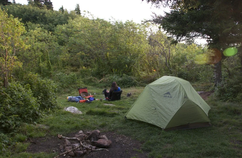
When they're not in use, the Forest Service in Washington and Oregon rents out about 70 houses and fire towers that the Civilian Conservation Corps built in the 1930s for the “smoke chasers” who patrolled the forests for fires. For $35 to $90 a night, campers interested in hiking, snowshoeing, skiing, horseback riding, fishing and hunting on the surrounding forest land have a small base to call home. (Friends and I stayed in another of these cabins, the Ditch Creek Guard Station, last winter. The story here.)

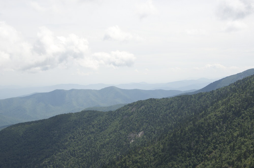
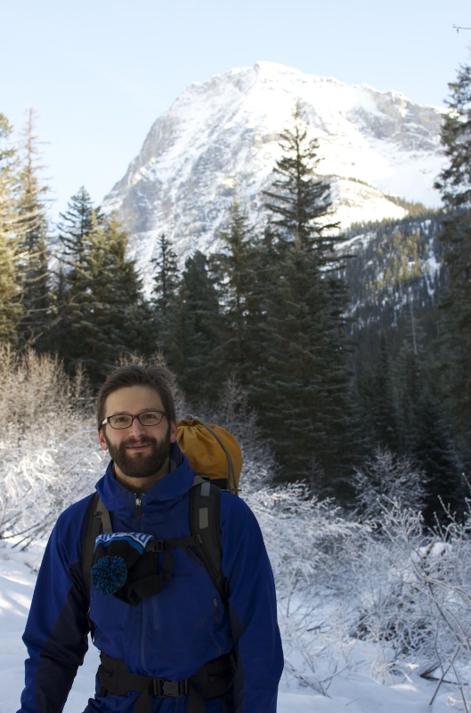
Built on a hilltop named for William T. Pickett, the homesteader who claimed it in 1898, the Pickett Butte Fire Lookout offers a single bed; a wall heater, stove, mini-fridge, and lanterns all powered by propane; and wall-to-wall windows providing expansive views of the Jackson Creek Drainage area and distant higher peaks. We used the rickety plastic egg-crate pulley to lug up the necessities (i.e. sleeping bags, warm clothes, coffee, boxed wine, and cheese) and settled in. Lucky for us rain-weary Portlanders, we enjoyed clear, sunny, 60-degree days, and T-shirts — in February!

DSC_0042

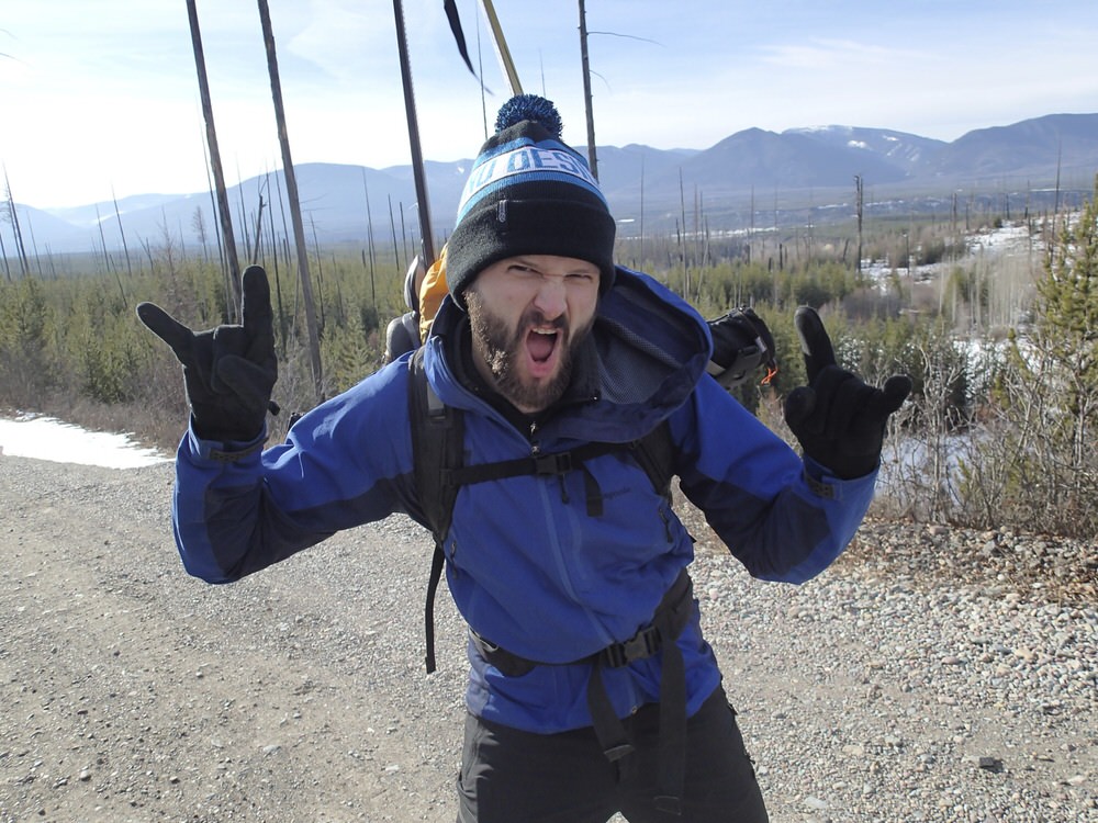
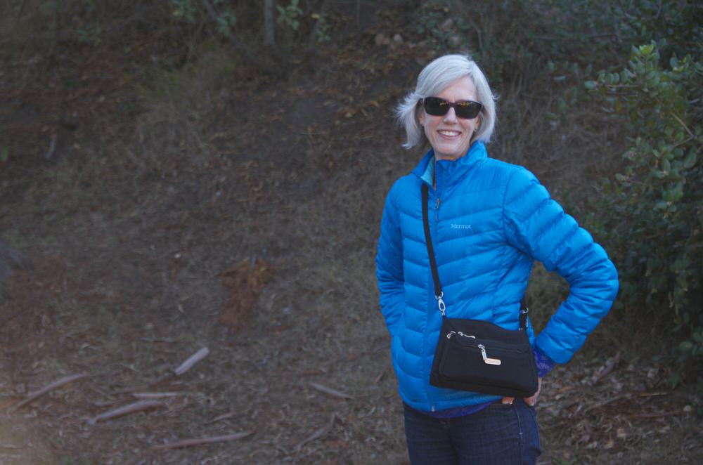
 Donnie, acclimating to life on stilts. In his favorite shirt.

DSC_0055

The cabin's interior.

DSC_0128

Our mapping tool, on a wooden stand in the center of the cabin, would have allowed us to pinpoint the exact location of any smoke we saw in the distance. We spent hours practicing just in case.

DSC_0181

 The privy, while handy on special occasions, was extremely inconvenient for regular use, being four precarious flights of stairs below. Not to worry: we figured out a workable system.

DSC_0212

Physics at work: we used water in the bottom of a translucent bottle to magnify a headlamp's light and an upturned bowl to up the volume on the music. (Cush camping, admittedly.)

DSC_0408

 Veggie egg cheese scrambles + french press coffee = the breakfast of champions

When you're living up in the air (in an area without many hiking trails at least), the activities of the sky outside play a pretty central role in your life. The sunset colored the sky deep pinks and purples and cast a warm glow over everything in the cabin.

DSC_0173

DSC_0250

And when we woke up the next morning, the clouds that had rolled in overnight still filled the valleys below us.

DSC_0390

DSC_0391

photo_2

A random pretty: a waterproof leaf in the gravel road leading up to the cabin.

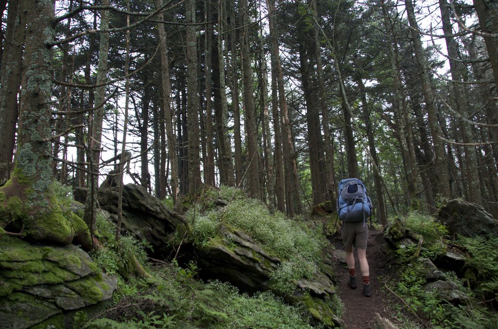
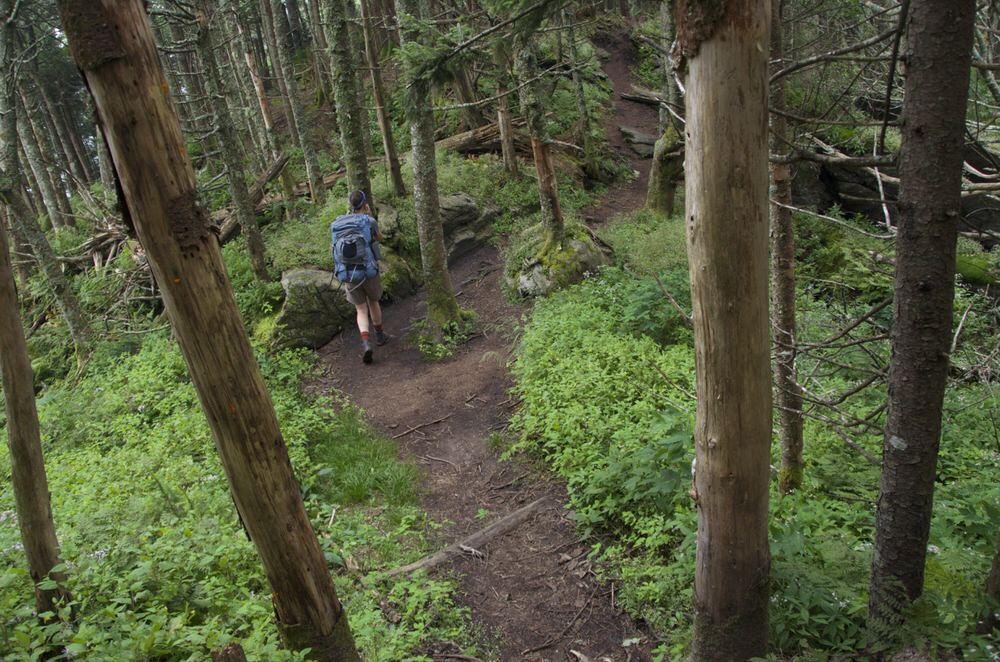
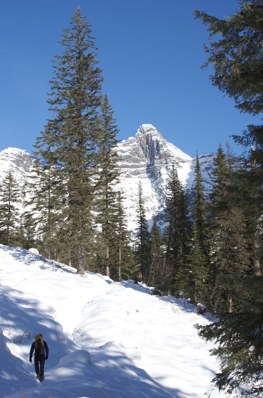
On Day Two, we took a two-hour road trip to Crater Lake for some cross country skiing, entering a white winter setting that was a stark contrast to our sun-drenched paradise. From the south entrance, we headed clockwise along the snow-covered road that circles the lake, meandering off trail a few times across the meadows sloping down from the rim.

DSC_0302

Donnie and Wizard Island, the cinder cone at the west end of the lake.

DSC_0283

DSC_0344

Mount McLoughlin in the distance

photo

Cutting the cheese (more literally than usual).

DSC_0333

DSC_0383

Oh, just stretching. Or something.

The dining options near Crater Lake in winter are limited, but upon a recommendation we picked up on the road, we stopped on our way back to base camp at José's Mexican Restaurant, an unassuming hole-in-the-wall spot six miles past the town of Prospect. The family-run establishment serves up fajitas and enchiladas made with fresh ingredients and scratch-made tortillas. Delicious. Because the place was empty and we didn't want to feel lonely, we ate in the adjoining Gorge Lounge bar, where a group of mustachioed locals chatted with the bartender while drinking Budweiser and Coors and half watching an obstacle course TV show involving rotating foam arms and whipped cream. One of the men started sputtering and snorting in a dramatic fake coughing fit before realizing we were behind him eating. He apologized, saying he didn't realize the place "had company."

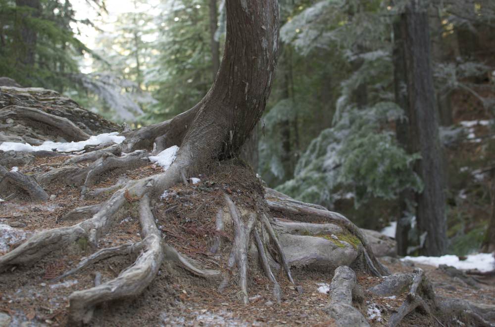
After lowering out stuff our of the fire lookout on Day Three to head back to Portland, we made another stop. I wasn't aware before, but the Umpqua National Forest boasts an extremely impressive feature: the world's largest sugar pine. We had to pay homage.

DSC_0422

The 400-year-old tree, measured in February 2012 at 255 feet, towers over its companions. The base of this tree has a giant chainsaw-induced wound from its run-in with vandals in 2000. (Who DOES that?!)

A day in The Dalles

Many adventures begin in The Dalles, the end-point of the main Oregon Trail, a small city on the banks of the Columbia 85 miles east of Portland. The wide open roads just outside of town, sparsely trafficked and surrounded by rolling farmland, make for some excellent cycling. dalles

When it's pouring in Portland, you can usually find sun in The Dalles.

While I'd used The Dalles (rhymes with "pals") as a departure point many times, I'd never actually stopped to get to know the town. And so Donnie and I decided to visit without bikes in tow. Rather than clipping on our helmets and pedaling off as soon as we arrived, we lingered for an afternoon, wandering  up and down the streets, observing the details we never noticed when we were on our way somewhere else.

We discovered a working-class city struggling for a comeback from the long-ago collapse of the aluminum industry — and succeeding in quite a few instances. We encountered a thorough mix of elaborate and gritty: ornate, turn-of-the-century properties sitting shoulder-to-shoulder with plain, uninhabited storefronts with "for lease" signs in the windows; a fancy French bakery, a brewpub in the old brick courthouse building, and recently renovated Moorish-style theater down the street from an empty car dealership, a cheap steakhouse, and a shop selling bedazzled tangerine-colored prom dresses.

The city is certainly trying: an urban renewal agency has invested in the port district, a snazzy underpass that connects the city with the river (formerly separated by Interstate 84), and various buildings downtown, including an historic hotel, a flour mill, and a Masonic lodge. (In 2005, Google established a server farm in town as well, but not much as changed as a result, because the company keeps its operation top secret.)

Here are a few of the sights we came across during our ramble:

madison lane

Sunshine Mill, a 130+-year-old wheat mill, which still contains the old flour milling equipment — and apparently now a wine bar, bocce ball court, and performance venue as well

DSC_0564

A functioning-since-1905 blacksmithing shop, with a particularly cool sign.

Recreation

No better recreation than bowling and prime rib. Amiright??

The ticket booth for the old, Moorish-style Granada Theater, which, built in 1929, was the first place west of the Mississippi to show movies with sound. It reopened in the last few years as a live performance venue. (Historic pics here.)

DSC_0615

DSC_0679

One of many vacant properties downtown seeking tenants. (You'd get jazzy windows!)

White and wires

A back alley

A shadow and its fire escape.

window lines

Oh, you know: air conditioners!

Steaks, burgers, beer

Down by the river-side train tracks.

While I'm sure we'll still frequently breeze through The Dalles on our way to the open road, we're also likely to hang around longer after we return — for coffee, pastries, beer, or a quick round at the bowling alley.

Washington's Goat Rocks — and the ever-present Mount Adams

Mount Adams photo-bombed almost every picture I tried to take during my hike in the Goat Rocks a few weekends ago. I couldn't snap a photo of scree fields, glacial lakes, moss-covered trees — anything — without the 12,200-foot mountain creeping into the frame somehow.

The Lily Basin Trail (... and Mount Adams)

Ten trees (... and Mount Adams)

Golden trail-side grasses (... and Mount Adams)

Donnie and I started our 13-mile hike through the Southwest Washington wilderness at the Snowgrass Flats trailhead. We ascended about 1,600 feet into a bowl formed by various Cascades, then crossed alpine meadows and passed the partially frozen Goat Lake before descending back down toward Berry Patch. Though the marmots were less feisty and the wildflowers less plentiful than my last visit, earlier in the season back in 2010, we enjoyed stunning, wide-open views everywhere we looked.

Though Adams acted a lot like the drunk annoying guy at the party, I forgave it — and actually did manage to capture a few pictures sin mountain:

Fuzzy little mop head

A creek-side flower slightly past its prime

Whoops! Slipped in again.

Donnie and the valley, around mile 9

Descending along Goat Ridge trail toward the end of the day